
Things to do round Ballaghaderreen
Sightseeing
Vast, lush nature area with meadows, walking paths, picnic grounds and a 12th-century abbey ruins.
105 locals raden deze aan
Lough Key Forest Park
Vast, lush nature area with meadows, walking paths, picnic grounds and a 12th-century abbey ruins.
This is a true Irish rural experience. Explore Ireland entirely away from the tourist crowds. Your host - local farmer Eddie Joe Dooney - is an expert on traditional farming techniques, and the history of the local area, including the history of the land on which you are staying.
Join him in the bog to cut some turf, then retire to the fireside for some tea and traditional music.
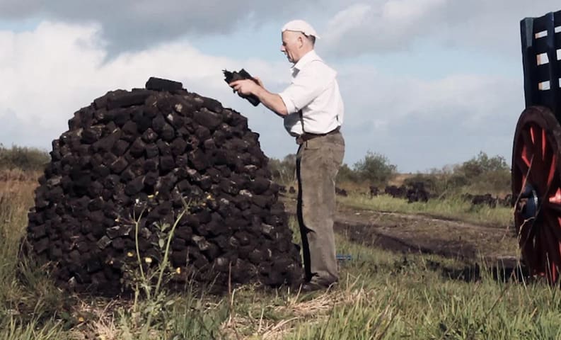
Ireland West Farm Stay
This is a true Irish rural experience. Explore Ireland entirely away from the tourist crowds. Your host - local farmer Eddie Joe Dooney - is an expert on traditional farming techniques, and the history of the local area, including the history of the land on which you are staying.
Join him in the bog to cut some turf, then retire to the fireside for some tea and traditional music.
Located on a tiny island in the middle of Lough Key, this castle is a national monument. Accessible only by boat, services are available from loughkeyboats.com
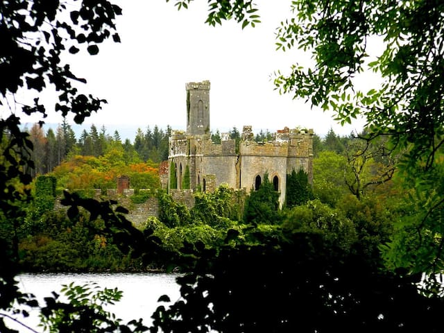
McDermott Castle
Located on a tiny island in the middle of Lough Key, this castle is a national monument. Accessible only by boat, services are available from loughkeyboats.com
Religious/Spiritual
Since the Apparition on the 21st of August 1879, pilgrims and visitors have been welcomed to Knock Shrine from all four corners of the world. Knock offers a peaceful, contemplative space in which to pray, to reflect and to reconnect.
32 locals raden deze aan
Knock Shrine
Since the Apparition on the 21st of August 1879, pilgrims and visitors have been welcomed to Knock Shrine from all four corners of the world. Knock offers a peaceful, contemplative space in which to pray, to reflect and to reconnect.
Croagh Patrick, nicknamed 'the Reek', is a mountain with a height of 764 m and an important site of pilgrimage in County Mayo, Ireland. The mountain has a pyramid-shaped peak and overlooks Clew Bay, rising above the village of Murrisk, several miles from Westport. It has long been seen as a holy mountain.
132 locals raden deze aan
Croagh Patrick
Croagh Patrick, nicknamed 'the Reek', is a mountain with a height of 764 m and an important site of pilgrimage in County Mayo, Ireland. The mountain has a pyramid-shaped peak and overlooks Clew Bay, rising above the village of Murrisk, several miles from Westport. It has long been seen as a holy mountain.
The Four Altars, a ruin of penal times is situated about 5km from Ballaghaderreen town centre on the main Sligo Road. You will see it on your right-hand side in a field outside of Ballaghaderreen town. This monument was used in Ireland at a time when Catholicism was banned in the country under the Penal laws of the late 17th and early 18th centuries. These laws forced Catholics to practice in secret resulting in monuments such as the Four Altars. It was built by the Costellos of Cregan-na-Grant. It was constructed on a hill so the priest could see approaching English soldiers and he could flee to avoid being arrested. There are four alcoves, each containing an altar. The four altars face north, south, east and west so the priest was able to get shelter from the prevailing wind and rain when saying mass.
The Four Altars resides in its natural state of preservation on an unspoiled landscape. Please ask landowners permission and beware of livestock.
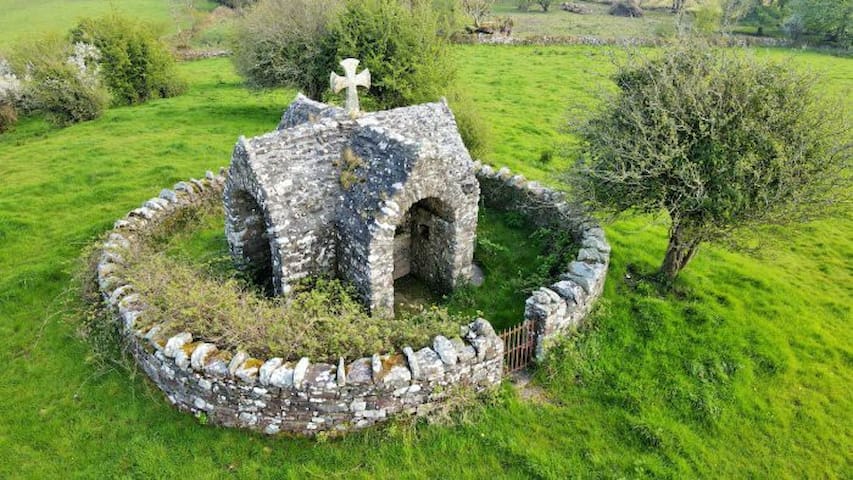
Four Alters
The Four Altars, a ruin of penal times is situated about 5km from Ballaghaderreen town centre on the main Sligo Road. You will see it on your right-hand side in a field outside of Ballaghaderreen town. This monument was used in Ireland at a time when Catholicism was banned in the country under the Penal laws of the late 17th and early 18th centuries. These laws forced Catholics to practice in secret resulting in monuments such as the Four Altars. It was built by the Costellos of Cregan-na-Grant. It was constructed on a hill so the priest could see approaching English soldiers and he could flee to avoid being arrested. There are four alcoves, each containing an altar. The four altars face north, south, east and west so the priest was able to get shelter from the prevailing wind and rain when saying mass.
The Four Altars resides in its natural state of preservation on an unspoiled landscape. Please ask landowners permission and beware of livestock.
City/town information
Westport is a town on the edge of an Atlantic inlet, on Ireland’s west coast. In the Georgian town centre, stone bridges link the tree-lined promenade on the banks of the Carrowbeg River. Rockfleet Castle and Burrishoole Abbey, both to the northwest, have ties to the 16th-century pirate queen, Grace O’ Malley. The Great Western Greenway bike and pedestrian trail runs from Westport to Achill Island, in the northwest.
A great town for traditional music, The Chieftains' own Matt Malloy, owns a pub who's music sessions are legendary.
141 locals raden deze aan
Westport
Westport is a town on the edge of an Atlantic inlet, on Ireland’s west coast. In the Georgian town centre, stone bridges link the tree-lined promenade on the banks of the Carrowbeg River. Rockfleet Castle and Burrishoole Abbey, both to the northwest, have ties to the 16th-century pirate queen, Grace O’ Malley. The Great Western Greenway bike and pedestrian trail runs from Westport to Achill Island, in the northwest.
A great town for traditional music, The Chieftains' own Matt Malloy, owns a pub who's music sessions are legendary.
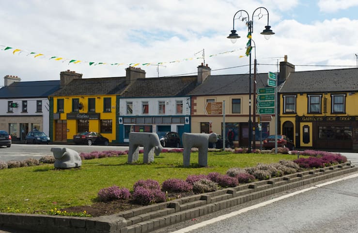
Ballaghaderreen (Bealach an Doirín, ‘The Way of the Little Oak’)is a strategically placed town situated beside the national N5 Dublin/Castlebar route close to the Mayo border in north-west Roscommon.
Ballaghaderreen has operated as a fairs and market town since the 1700s and continues in the role of a large market town and service centre for the surrounding areas.
The closest town to the cottage, this will be your main stop for the supermarket and other essentials.
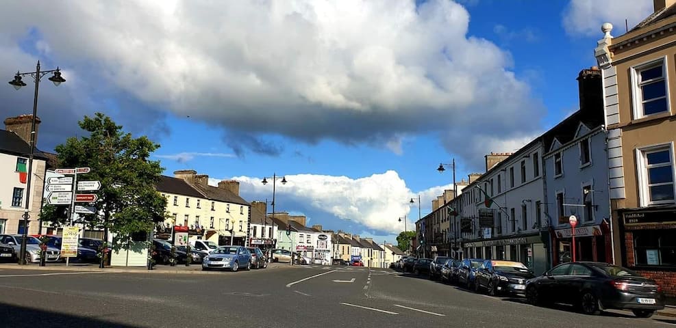
Ballaghaderreen
Ballaghaderreen (Bealach an Doirín, ‘The Way of the Little Oak’)is a strategically placed town situated beside the national N5 Dublin/Castlebar route close to the Mayo border in north-west Roscommon.
Ballaghaderreen has operated as a fairs and market town since the 1700s and continues in the role of a large market town and service centre for the surrounding areas.
The closest town to the cottage, this will be your main stop for the supermarket and other essentials.
Charlestown, located on the intersection of two National Primary routes, the N17 and the N5, along the eastern border of County Mayo, has been hosting visitors for nigh on one hundred years . . . and in ever increasing numbers since the development of Ireland West Airport Knock, just three miles down the road. It is not surprising when one considers the fine bank of approved accommodation in the town and the excellent restaurants which specialise in home-cooked quality food.
Popularly known as the International Gateway to the West of Ireland, Charlestown is now, with the development of Ireland West Airport Knock, the most accessible town in the West of Ireland.
There are a wide range of activities available to visitors in the area: golfing (7 miles), fishing in the many lakes and rivers in the area, cycling trips on quiet, traffic-free country roads and exploration of the many archaeological remains in the area, with mapped walking routes in beautiful scenic and rural surroundings.
Charlestown was built in the middle of the last century, on the initiative of Lord Dillon's agent, Charles Strickland adjoining Bellaghy in County Sligo. The town has now a population of approximately 800 people. Visitors to Charlestown are welcomed with true West of Ireland hospitality.
The town is well planned with wide open streets and parking facilities. Located on the intersection of two National Primary routes, the N17 and the N5, Charlestown is an ideal stopover or centre to stay and visit other locations.
Charlestown
Charlestown, located on the intersection of two National Primary routes, the N17 and the N5, along the eastern border of County Mayo, has been hosting visitors for nigh on one hundred years . . . and in ever increasing numbers since the development of Ireland West Airport Knock, just three miles down the road. It is not surprising when one considers the fine bank of approved accommodation in the town and the excellent restaurants which specialise in home-cooked quality food.
Popularly known as the International Gateway to the West of Ireland, Charlestown is now, with the development of Ireland West Airport Knock, the most accessible town in the West of Ireland.
There are a wide range of activities available to visitors in the area: golfing (7 miles), fishing in the many lakes and rivers in the area, cycling trips on quiet, traffic-free country roads and exploration of the many archaeological remains in the area, with mapped walking routes in beautiful scenic and rural surroundings.
Charlestown was built in the middle of the last century, on the initiative of Lord Dillon's agent, Charles Strickland adjoining Bellaghy in County Sligo. The town has now a population of approximately 800 people. Visitors to Charlestown are welcomed with true West of Ireland hospitality.
The town is well planned with wide open streets and parking facilities. Located on the intersection of two National Primary routes, the N17 and the N5, Charlestown is an ideal stopover or centre to stay and visit other locations.